Shiny App
Geocomputation
Bird survey visualisation
Data integration
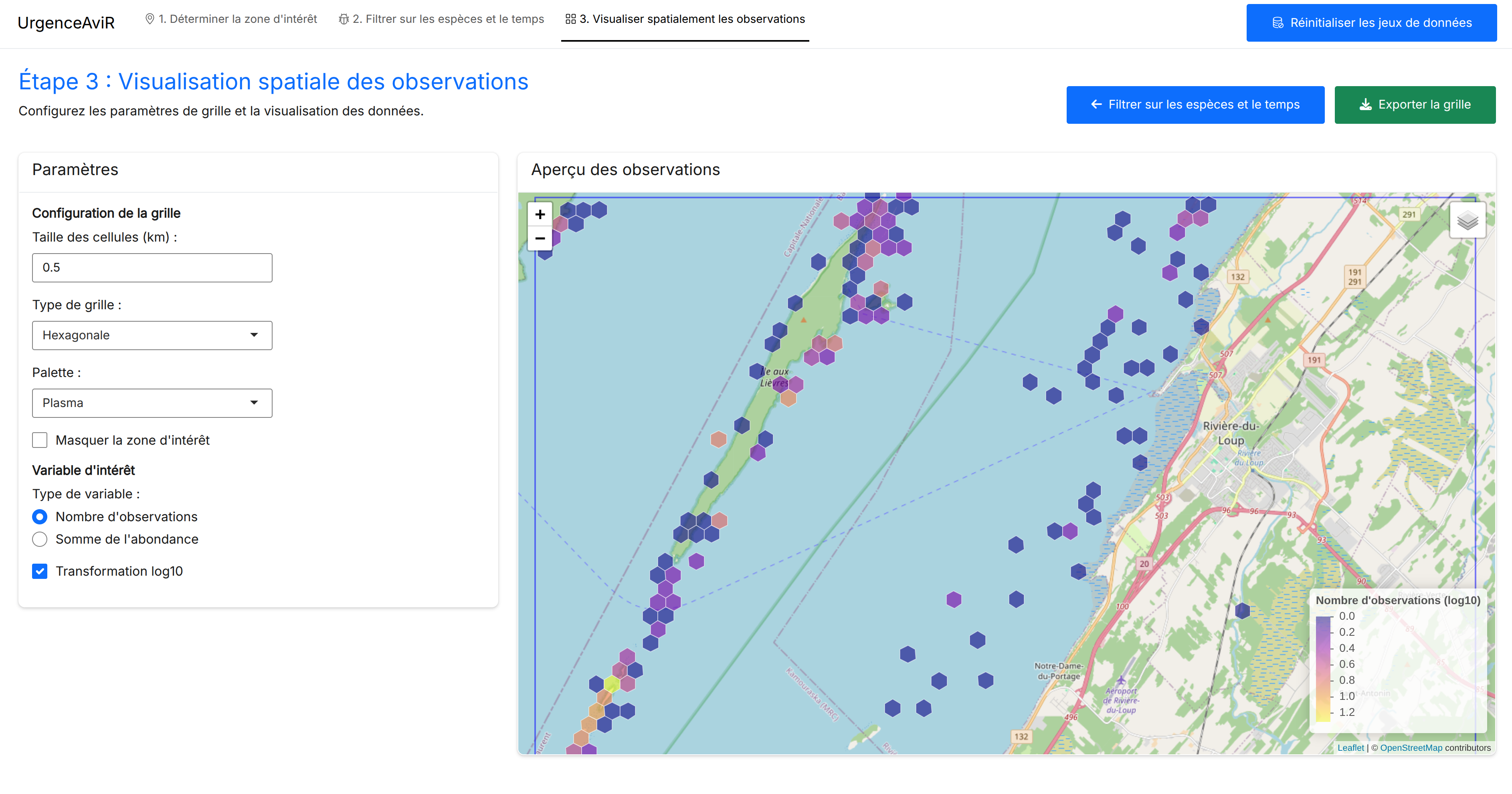
The urgenceAviR application consolidates and integrates various bird survey datasets collected in the St. Lawrence Estuary and River. It enables interactive exploration of these data and offers the ability to extract a set of shapefiles of the spatial distribution of birds for a given area of interest. This application strengthens the government’s capacity to conduct rapid risk assessments related to oil spills affecting bird populations.
Have a project in mind and want to work with us?
Reach out!